Hurontario LRT project uses ‘SmartBall’ to map hidden watermains
The Hurontario LRT projects have a smart drone to quietly map out watermains. Let's check it out.
Apr 14, 2021
Someone’s on the ball.
As crews continue to hunt for existing, and sometimes old, watermains along the route for the Hurontario Light Rail Transit (HuLRT) line, they wanted a way that didn’t just involve digging down and searching.
There are a number of techniques to find buried pipes and utilities. One of the more common methods involves a process called sub-surface utility engineering – called ‘SUE’ – where underground utilities are exposed by creating test pits, using pressurized water from a hydro-vac truck. However, the effectiveness of this method depends on how deep the watermain is. If the watermain is too deep, a method such as SUE may not do.
That’s where crews can now bring in SmartBall technology.
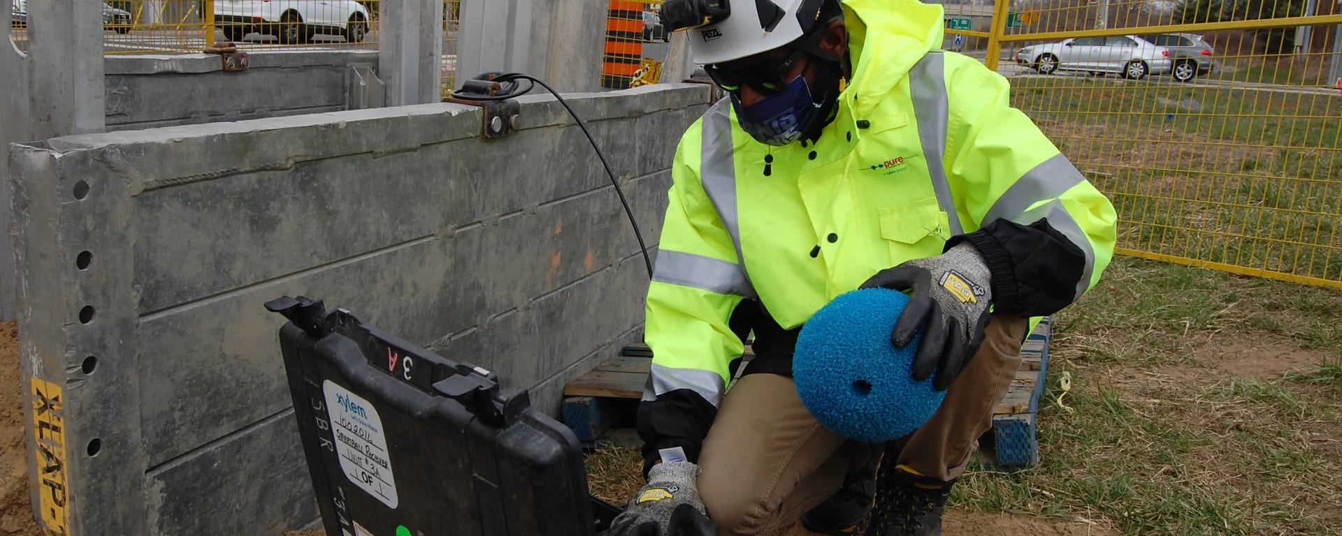
The SmartBall is an internal free-swimming inspection tool that can provide the coordinates for mapping of a pipeline. It will be used on the HuLRT project to identify the exact location of the watermain at the QEW 400-series highway, without using invasive excavation methods.
The SmartBall itself is built with an aluminum core that houses its power source and other electronic components used to calculate the precise location of the ball as it maps and floats its way through the buried infrastructure.
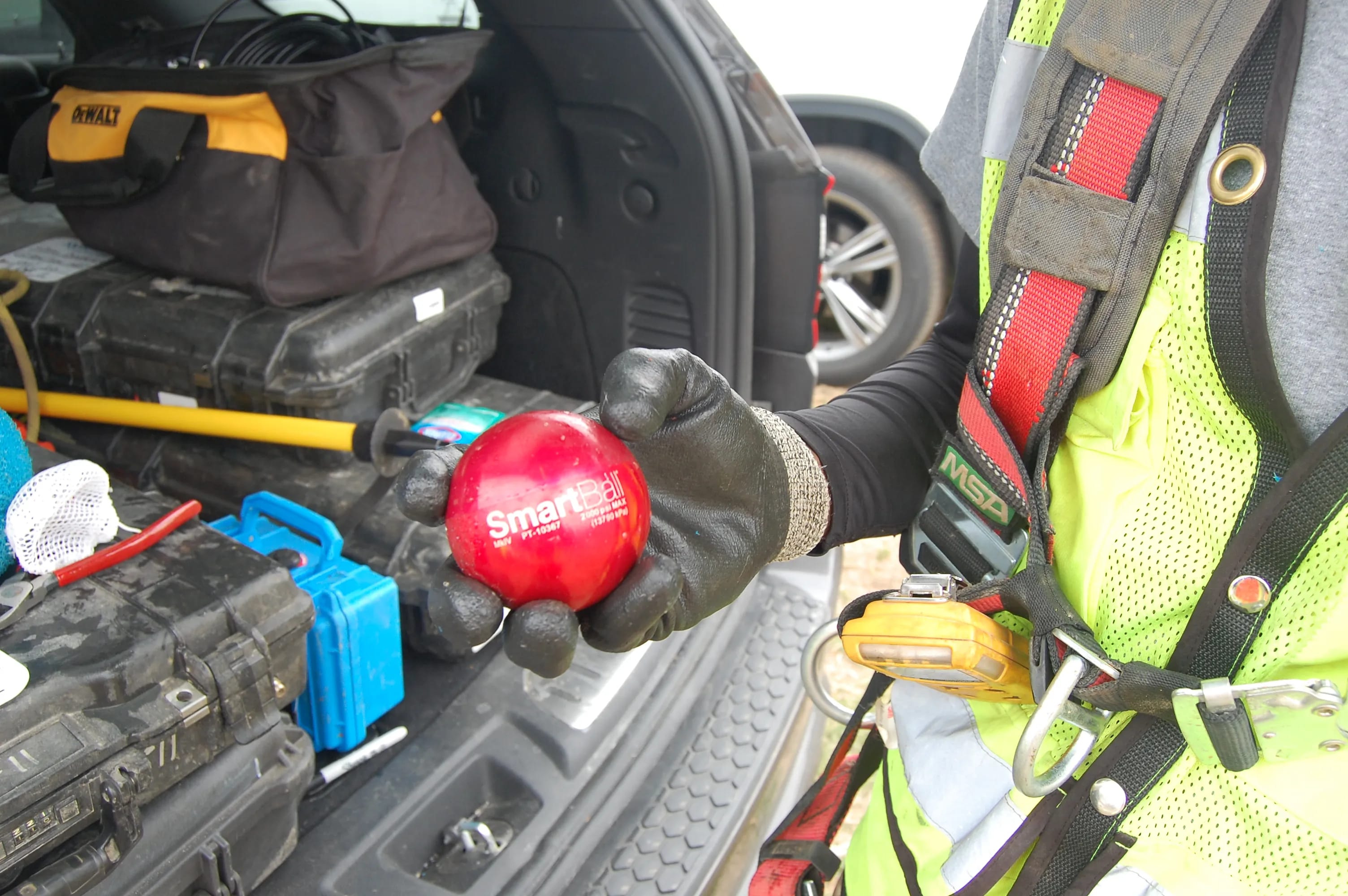
A closeup look at the SmartBall technology before it gets deployed. (Metrolinx photo)
And it’s stealthy. The core is encapsulated inside a protective outer foam shell that minimizes any noise the device generates while it travels through the pipeline. Using hydraulic flow, the SmartBall is inserted into the pipeline and travels downstream to capture location details by using the GPS transmitter housed in its core.
That’s one smart ball.