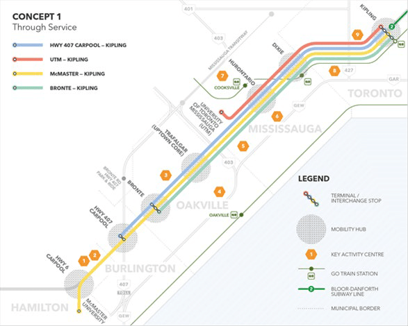
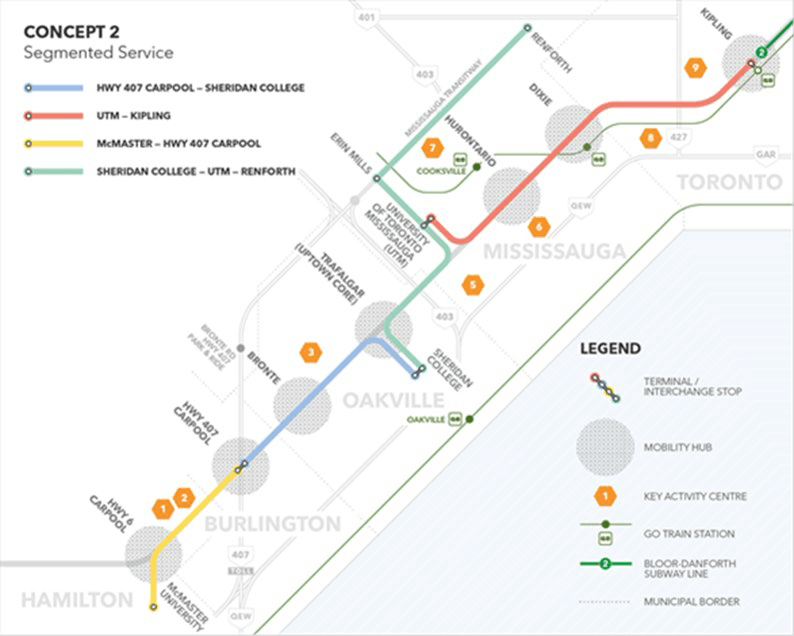
How design alternatives and pinch points are evaluated.

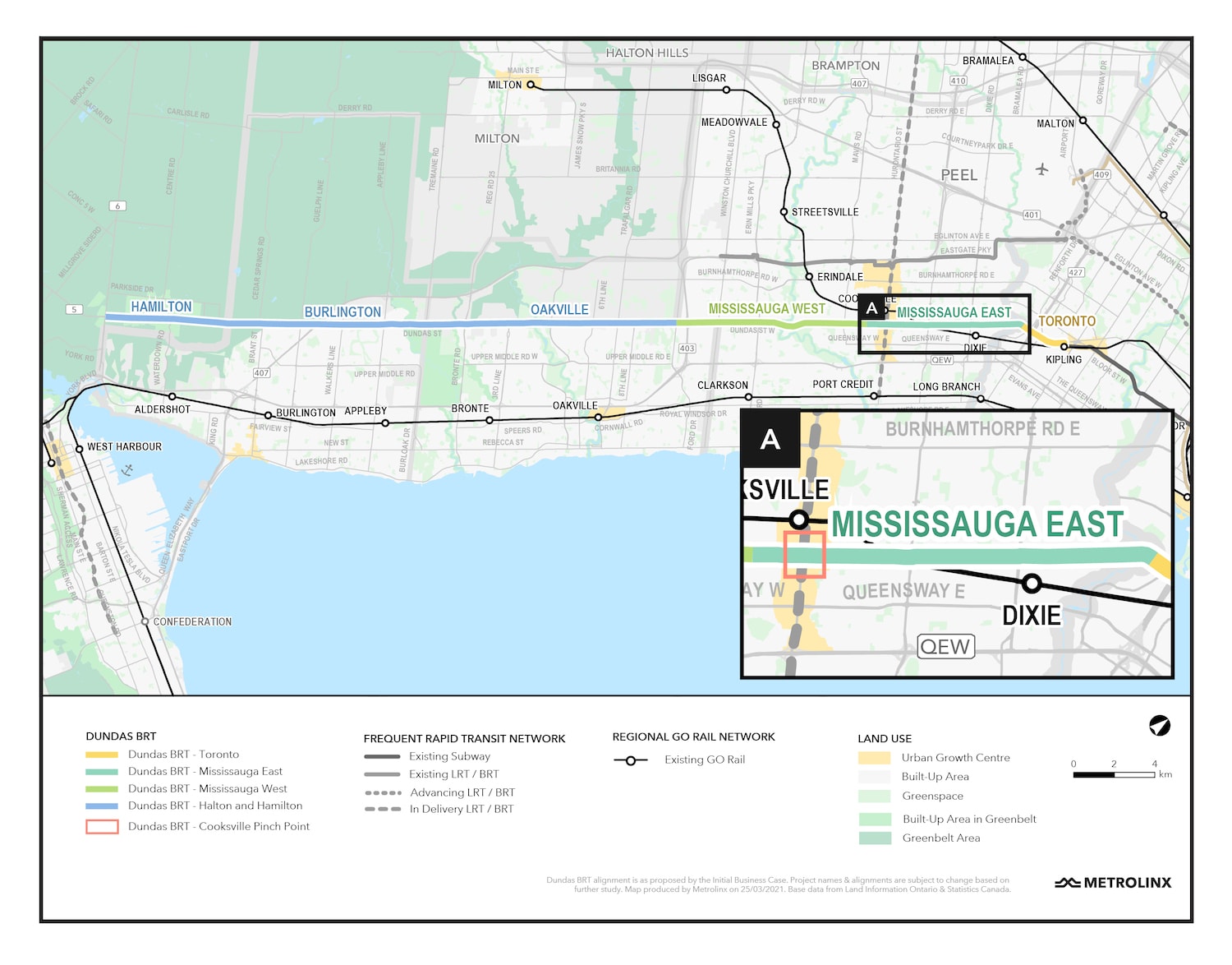
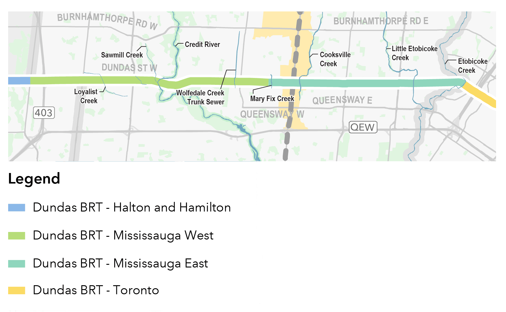
Dundas BRT
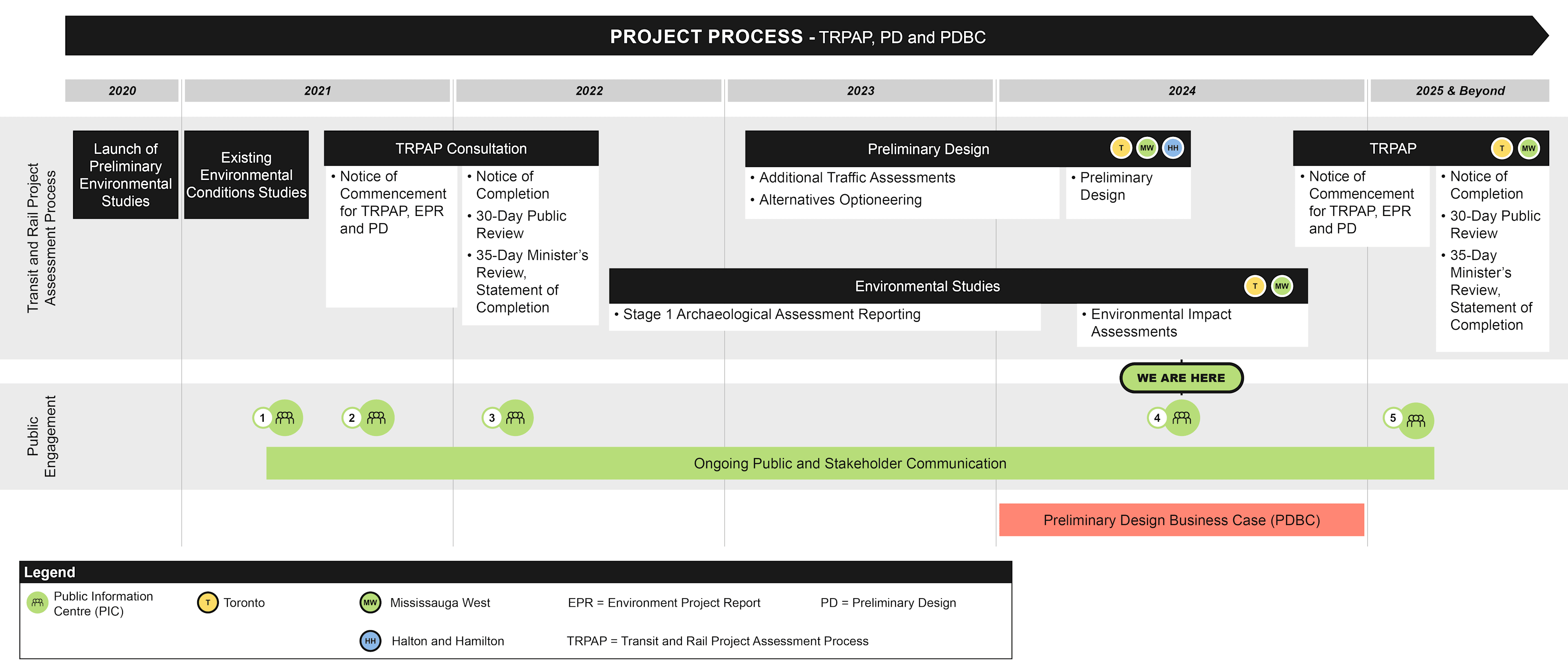
Environmental Project Report update
The Environmental Project Report (EPR) was available for a 30-day review period from February 23, 2022 to March 25, 2022. On April 27, 2022, the Minister of the Environment, Conservation and Parks issued a Notice to Proceed with the municipal transit project in accordance with Ontario Regulation 231/08. As the final step of the Transit Project Assessment Process (TPAP), Metrolinx and the City of Mississauga have issued a Statement of Completion in accordance with Ontario Regulation 231/08. We have also made available, online, our revised Environmental Project Report (EPR), EPR Errata, and revised Stage 1 Archaeological Assessment.
Development
Unlock economic and regional development along the corridor with 230,000 jobs within a 2 km radius
Ridership
Attract new ridership (~31,000 new riders per day)
Connectivity
Improve connectivity by connecting to other transit services operating along Dundas Street corridor
Quality of life
Improve quality of life by allowing 660,000 people living within a 2 km radius to go where they want to go
Key destinations
Provide key connections to Kipling Transit Hub and Etobicoke and Mississauga City Centres, plus access to key destinations along Dundas Street*
*Key destinations along Dundas Street such as:
- Residential and commerical areas;
- Educational institutions;
- Places of worship;
- Medical institutions;
- Parks and outdoor recreation; and
- Dining, entertainment and shopping destinations
The studies
Study Method
Methods undertaken to complete these studies include the following:
- Examine designated natural areas and planning policy areas.
- Vegetation community and plant inventories.
- Fish and fish habitat surveys.
- Wildlife and wildlife habitat surveys.
- Significant wildlife habitat and species at risk screening.
- Identify potential adverse effects and appropriate mitigation measures.
Existing environmental conditions
Toronto
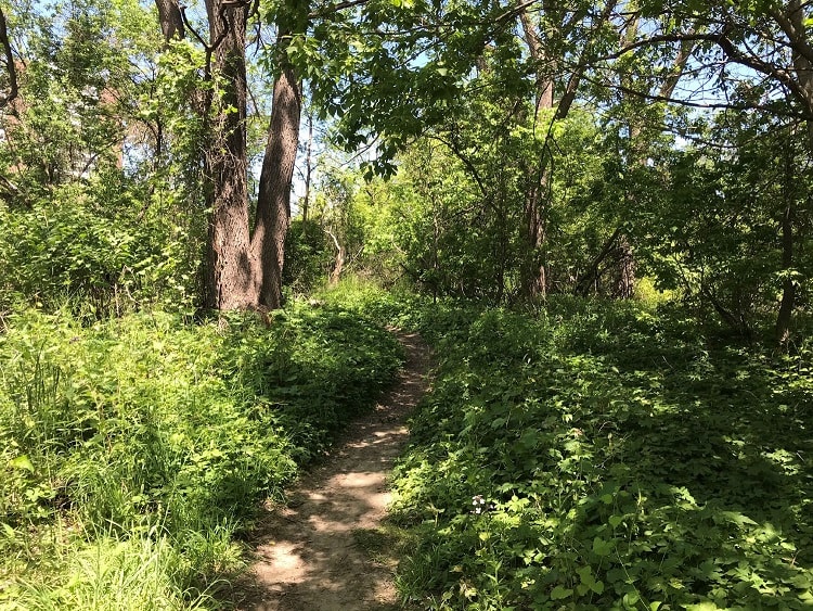
- The only natural vegetation community within the study area was identified along the forested banks of Etobicoke Creek. The forested ravines of Etobicoke Creek likely act as important wildlife corridors, allowing for the movement of wildlife between areas to seek food, shelter and mates within the City of Toronto’s Natural Heritage System.
- No vegetation communities were identified as, or anticipated to be, provincially significant.
- The fish community that inhabits Etobicoke Creek is primarily cool-warm water species that are tolerant of disturbances.
- The majority of the wildlife are common in the City of Toronto and are tolerant to disturbances, while a small proportion is comprised of sensitive or rare species.
Recreational trail in Toronto. Source: AECOM, 2021.
Mississauga East
- The study area includes a variety of urban, residential and industrial areas which are divided by several natural features including watercourses, riparian areas and vegetated corridors.
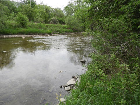
- Several watercourses cross the study area and provide habitat to a variety of fish species including Sawmill Creek, Glen Erin Brook (coolwater systems) and Etobicoke Creek, Little Etobicoke Creek and Cooksville Creek (warmwater systems).
- A wide variety of migratory birds nest within the study area and Cliff Swallows, Barn Swallows, Eastern Phoebe and American Robin were identified under the Etobicoke Creek bridge.
- Species at Risk are known to occur within the study area including: Barn Swallow, Chimney Swift and Snapping Turtle.
- Local wildlife corridors exist in several areas, primarily associated with watercourse, riparian areas and valley lands for small, medium and large mammals as well as turtles.
View of Etobicoke Creek looking downstream (south) from the bridge structure. A riffle exists downstream of the structure. Source: AECOM, 2021.
Mississauga West
- The study area includes a variety of urban, residential and industrial areas which are divided by several natural features including watercourses, riparian areas and vegetated corridors.
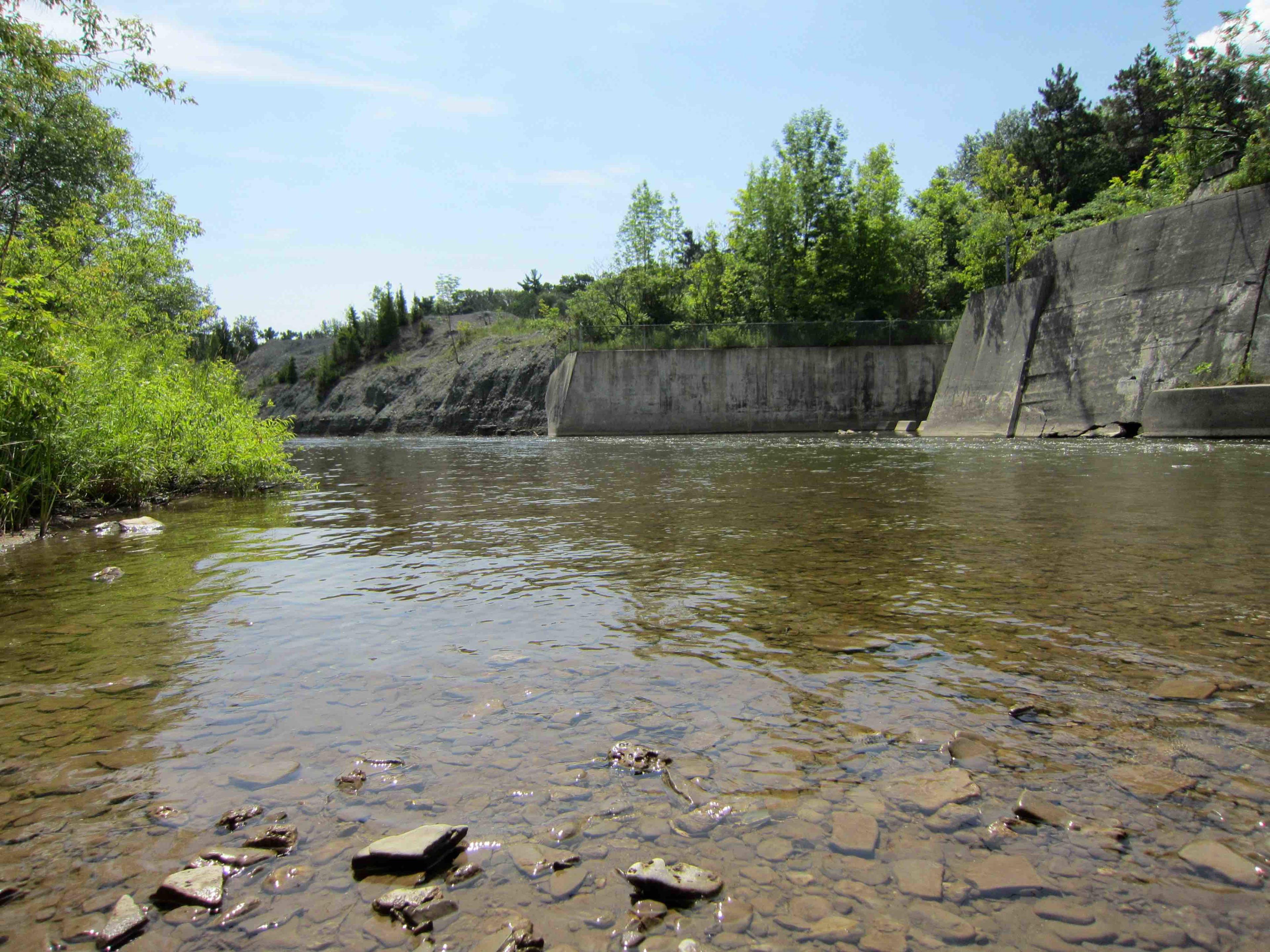
- Crossing the study area, Mary Fix Creek and the Credit River provide habitat to a variety of fish species, with the Credit River also providing migratory corridors for populations of salmon and trout.
- Several natural heritage features are found within the study area, including the Credit River at Erindale Areas of Natural and Scientific Interest (ANSI) and Erindale Park near the Credit River.
- A wide variety of migratory birds nest within the study area.
- Species at Risk are known to occur within the study area, including Barn Swallow, Chimney Swift and Snapping Turtle.
- Local wildlife corridors exist in several areas primarily associated with watercourse, riparian areas and valley lands for small, medium and large mammals as well as turtles. Several other wooded areas within the study area also provide corridors for bats, including the Big Brown Bat.
View of the Credit River flowing through Erindale Valley. Source: AECOM, 2021.
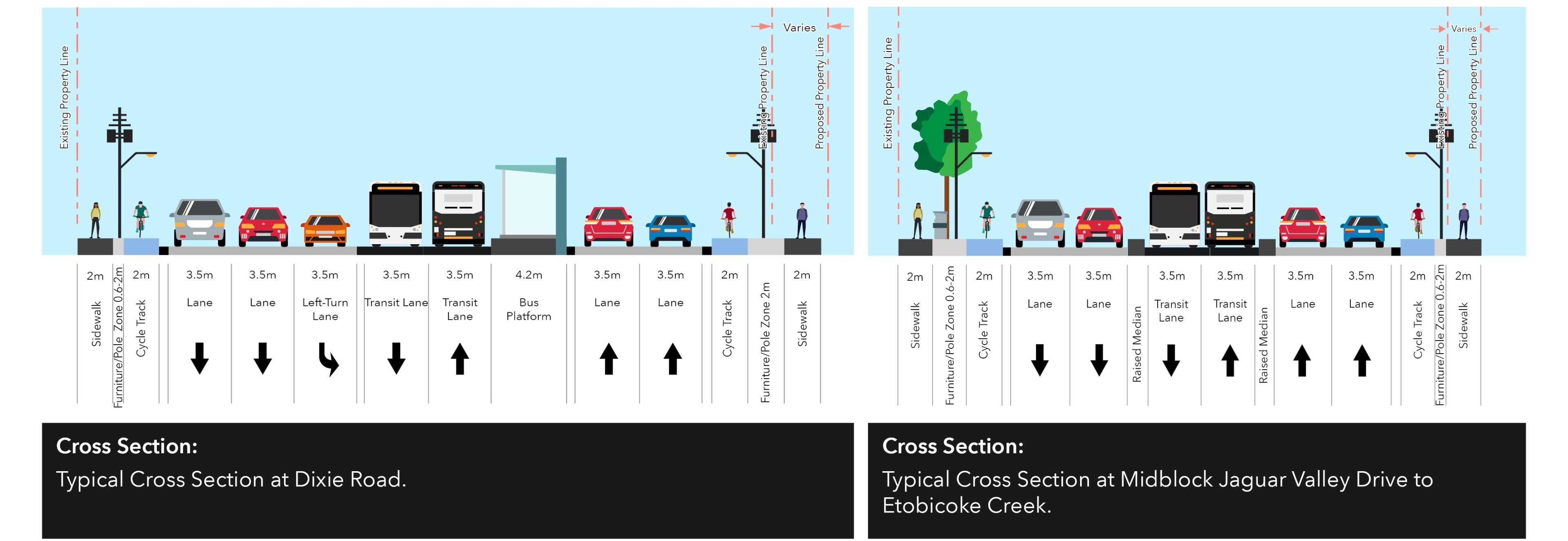
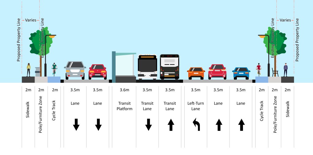
Dundas BRT pinch points